 de Bry Th.


 de Bry Th.
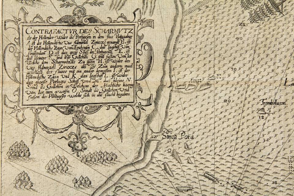
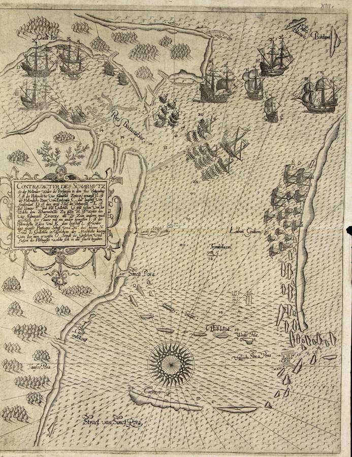
Contrafactur des Scharmutz
In part VIII of the Petits Voyages,
Latin version
Johann Theodor and Johann Israel de Bry,
Frankfurt 1607
(Suarez, Mapping of SE Asia, Periplus 1999: 184; Church 218)
Copper plate engraving, 33x26 cm,
Small margins (circa 1 cm), good print, no restorations
This map (plate XIII) comes from the Latin version of the Petits Voyages, part VIII, published by de Bry in 1607. It is the oldest surviving printed map showing Singapore. It came out in identical form in the German version of the same de Bry volume, published in 1606
The north is to the left. The map shows Sinca Pora with the Batasubar (Johor) river to the east. The Sea, south of Sinca Pora is more or less enclosed by key shaped, long stretching rows of islands with the widest opening to the east where two smaller islands, Bintam and Pedro Blanco guard the entrance. In the west runs the Straet of Sinca Pora. Inside the more or less enclosed sea south of Sinca Pora is a small island called Valsch Sinca Pora.
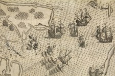
In the ample, half enclosed sea south of Sinca Pora Dutch and Portuguese ships are amassed and in battle in 1603 with the final aim of the control of the Strait of Malacca. A major Portuguese ship is enclosed by three Dutch ships in the mouth of the river Batasubar. One Portuguese galleon is escaping to the east, chased by the Dutch Zierikzee galleon.
This double page map shows the naval squirmishes between the Dutch (van Neck) and Portuguese in 1603 at the river Batasubar (r. Johor) in two sceneries in one plate. The struggle eventually led to the chase of the Portuguese from Malacca in 1606.