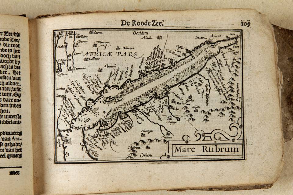
 Langenes, Barent
Mare Rubrum
From the atlas, Caert Tresoor,
Middelburg, the Netherlands, 1598
Tibbetts 1978, map 56
B/W as issued, 9x12,3cm
The first map exclusively dedicated Arabia and the Red Sea is in the Ptolemy edition, in Rome of 1478. It is called Sexta Asiae tabula. The first modern depiction of Arabia and the Red Sea is in Waldseemullers Carta Marina of 1516 of which one copy only is known to exist. The first printed modern map of Arabia and the Red Sea is Arabia Felix Nova Tabula by Gastaldi in 1548. Tibbets calls the Gastaldi 1548 map the first printed map to specifically deal with Arabia. That map was copied and enlarged by Ruscelli in 1561.
In that same year, 1561 Gastaldi produced a larger map ...seconda parte dellAsia including Arabia. The map takes innovations from Portuguese maritime sources, based the exploration of the Asian waters and lands from Vasco da Gama 1498 onwards. Starting with Ortelius the Dutch became dominant in printed maps and charts. One of their pioneers, Petrus Plancius, obtained a fine set of Portuguese manuscript maps made by Lasso. They served as the basis for the map of the Indian Ocean as published in Linschotens Itinerario of 1596. The map of the Red Sea here described is directly derived from that Linschoten map. The Red Sea is shown here for the first time as stand-alone printed map.
Red Sea
The Langenes map closely follows (Lasso) van Linschoten. It is quite distinct from the Porro map of 1596. On our map the bays are shown in distinct detail and places are clearly indicated: the result of direct observation. The emphasis is totally on the sea and sea shore. Present day Yemen shows Zebit after its mayor harbor at the Red Sea. Further North is Medina tabijabi ubi Mahumetis sepulchrum visitor, the place where Mohammed is buried. The utmost southern point is Aden. On the African side of the Red Sea many more places are shown than on for example Ortelius map Turcicum Imperium 1570.