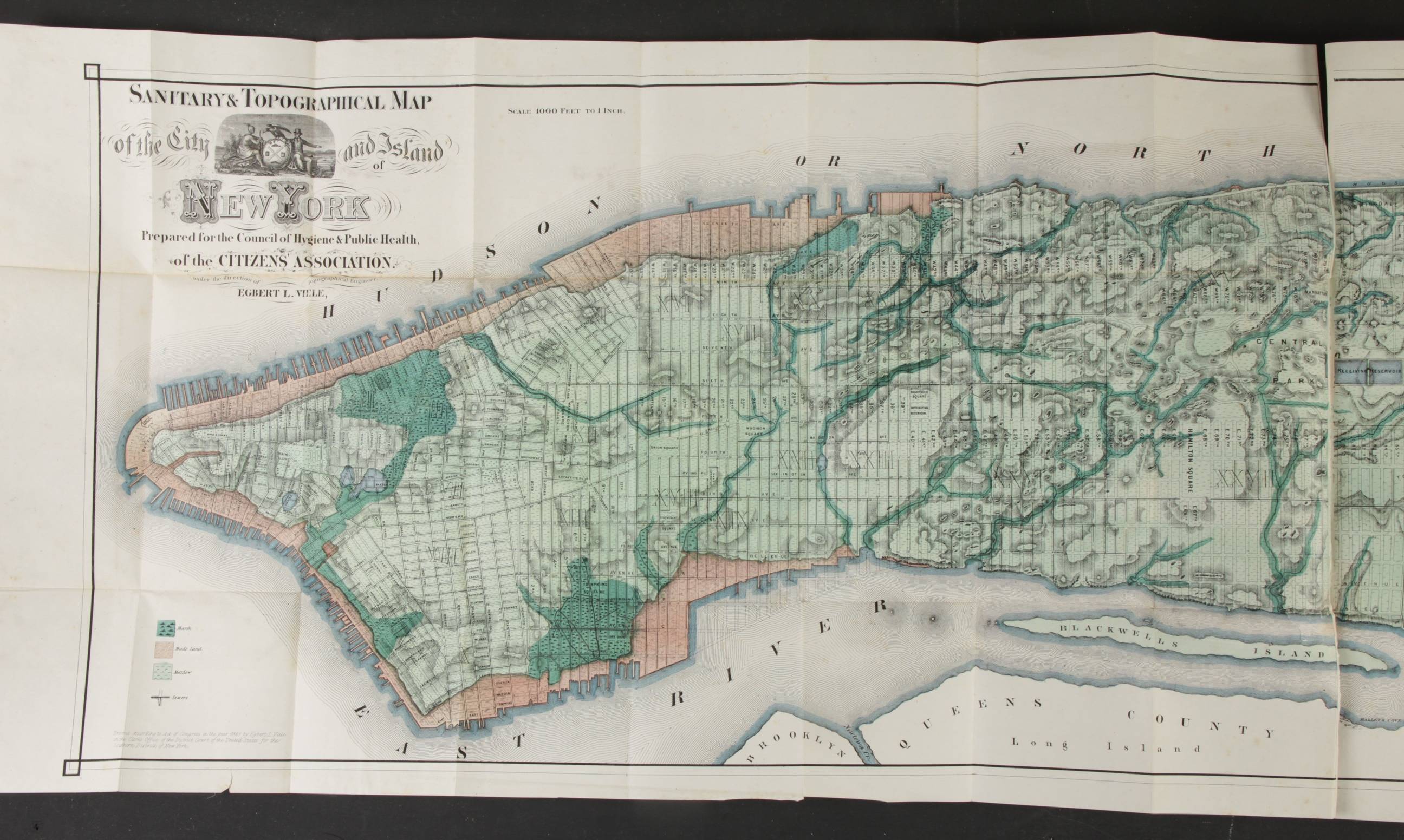
Report of the Council of Hygiene
Sanitary conditions of New-York
New York, Appleton and Co. 1866
In octavo, contemporary quarter black Morocco
Title in gilt on the spine
2 free blank end leaves; 18 pages;
FIRST PART: Title leaf ; Large folding map of New York
pp 21-36: Introduction
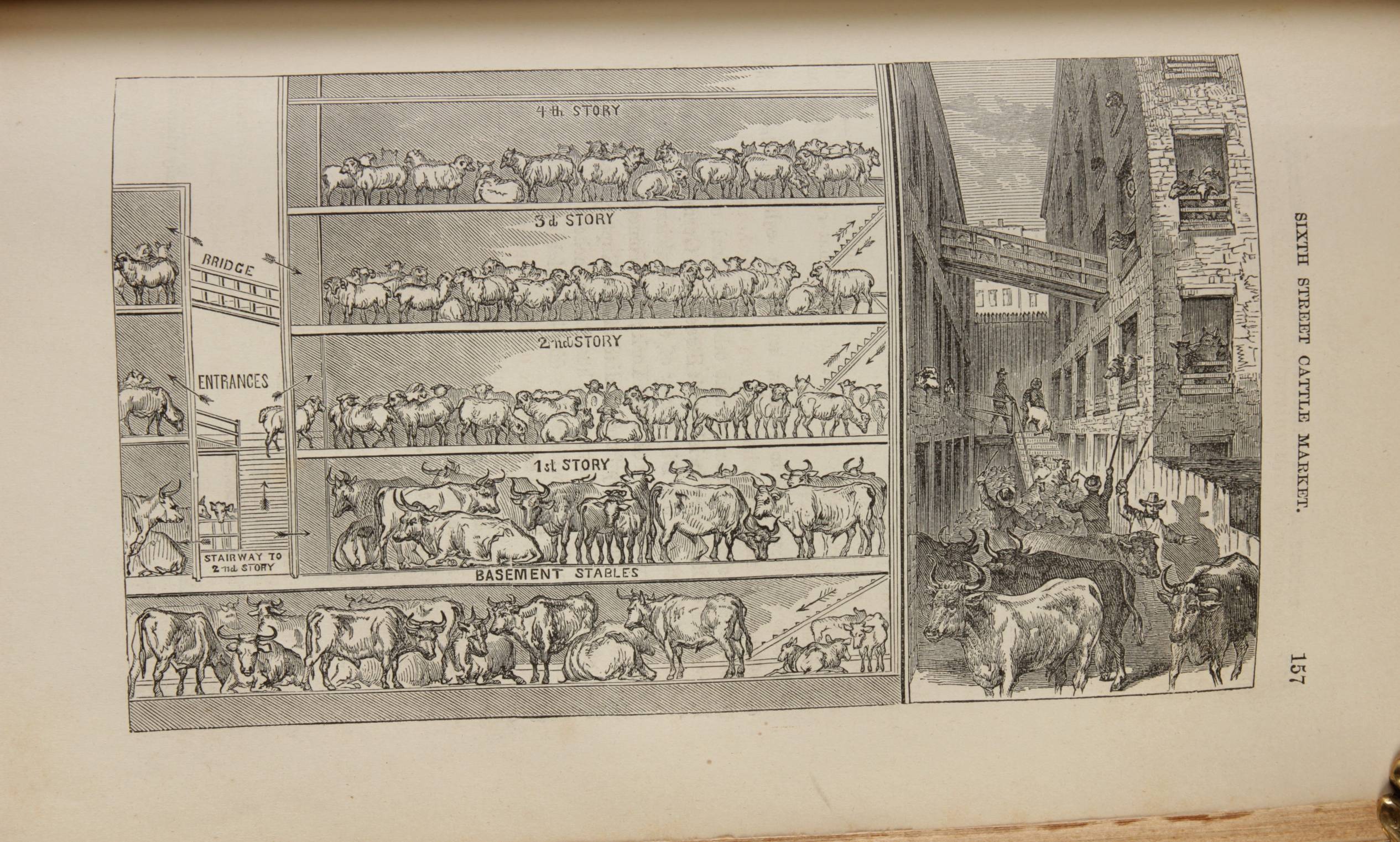
pp 37-144: Report ..on the sanitary condition of the city,
including 5 illustrations
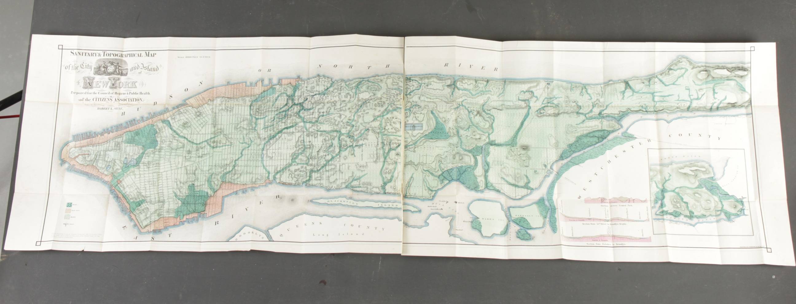
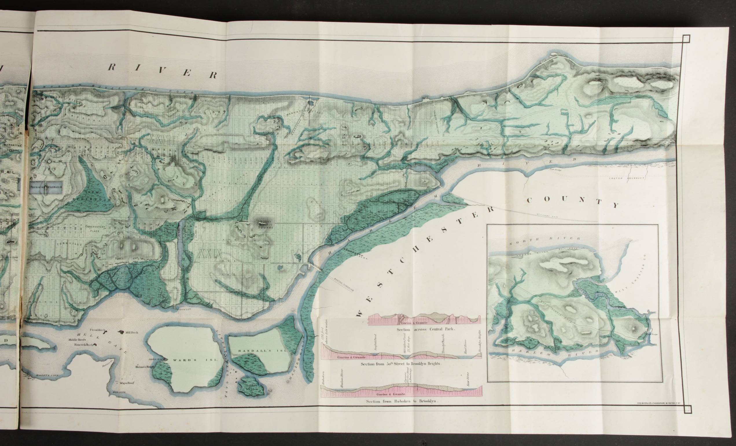
SECOND PART:
pp 1-350: Reports of the sanitary inspectors,
including one folding map and 46 illustrations
pp 351-360: Index
Condition: excellent
This is the second edition (first 1865) of a path breaking public health study by 29 teams in the 29 districts that constituted XIX century New York. It documents the direct ...
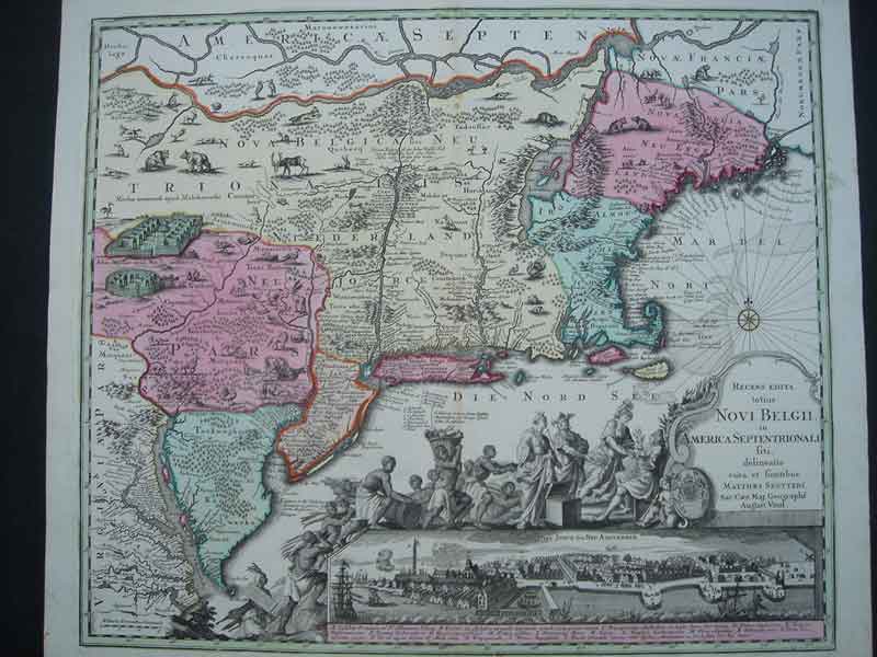
Province of New York and New Jersey
1777 Augsburg
One big map in two sheets
Original colour
Recens Edita Novi Belgii... (New York)
ca. 1730. Second state (Tooley 291).
Full contemporary colour. Inset view of New York. Large cartouche in B/W as issued.
Excellent print.