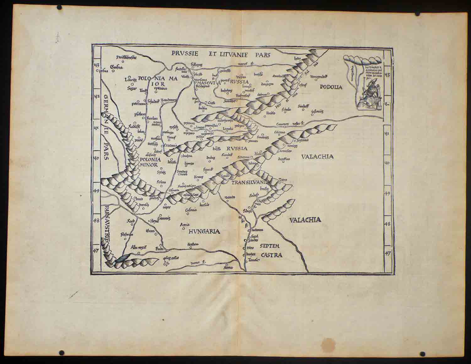
Tab. Moderna...Russiae
1535 - B/W as issued - some browning on the fold - spot in lower margin
Early map showing Russia and parts of present Eastern Europe
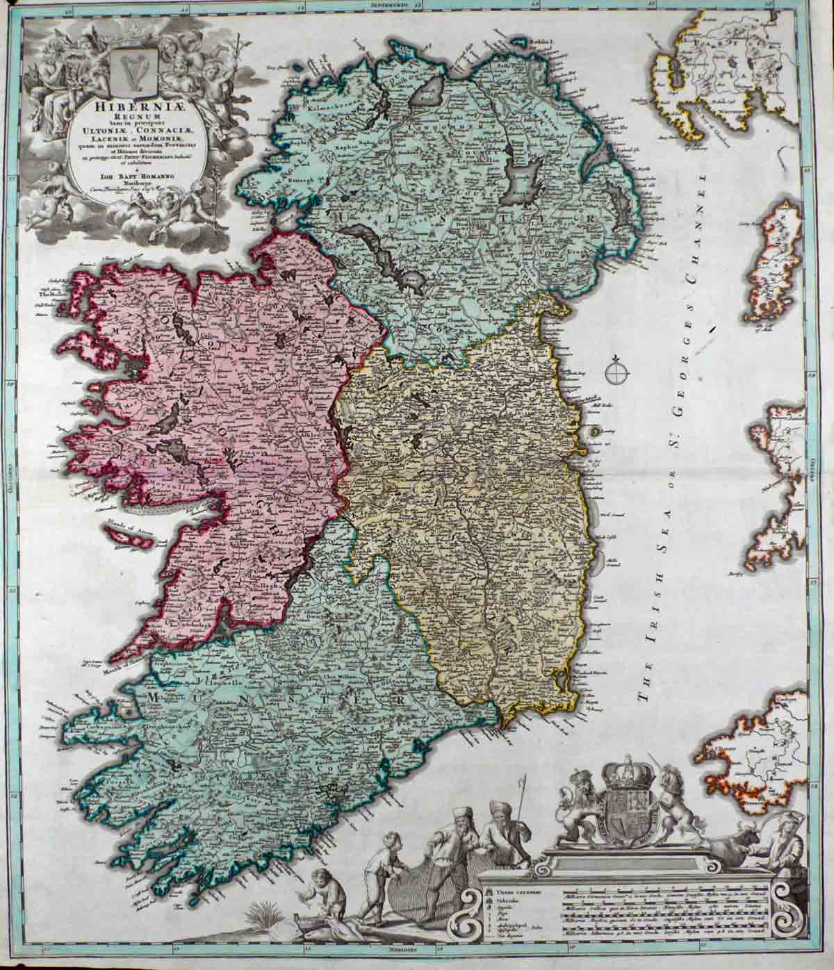
Hiberniae Regnum
c. 1730
Original colour
Excellent copy, nice contemporary colour and two cartouches in B/W, coast of England in contemporary outline colour.
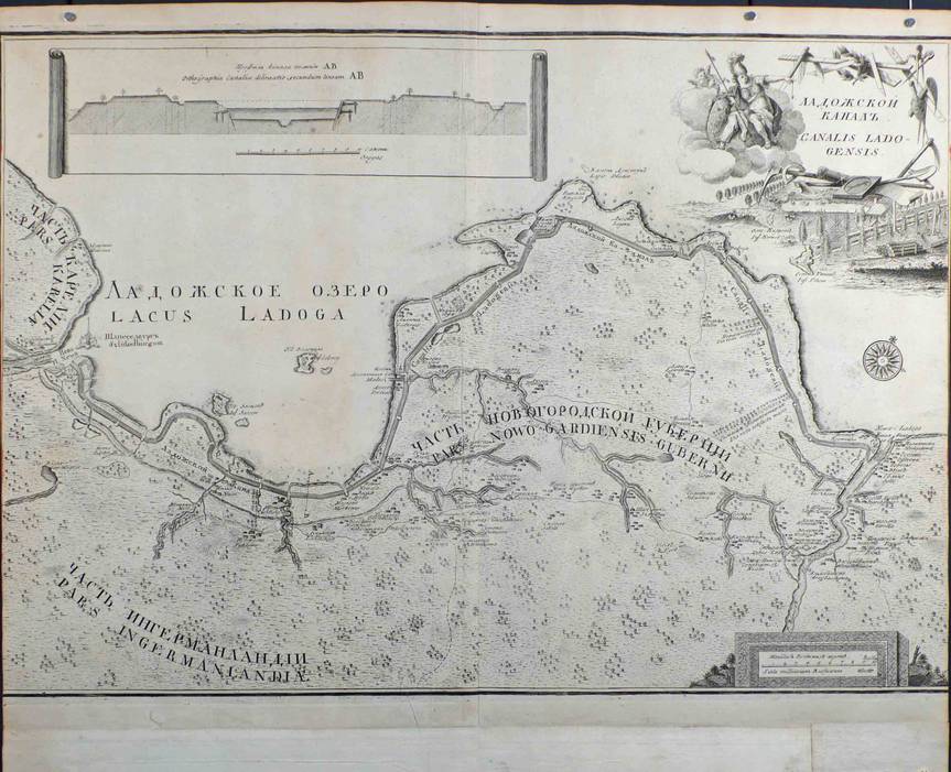
Canalis Ladogensis
c. 1743 - copper plate engraving - 50x58cm - B/W as issued - upper margin cut short, new margins added contemporarily on three sides to fit into the atlas russicus.
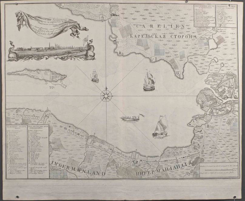
Sinus Finnicus von Crohnstadt bis St. Petersburg
Sinus Finnicus von Crohnstadt. c. 1743 - B/W copper plate engraving 48x62,5 cm - lower margin added contemporarily to fit into the Atlas Russicus.
One of a set of maps of the surroundings of new St. Petersburg/Lago Ladoga. This series appeared without any date and there are no traces of publication in documents of the Akademiya Nauk (Bagrow II, p 184). They were probably published by the end of 1743. It should be noted that the aforementioned series of maps were all repeated in a new edition by Seutter in Wien (Bagrow).
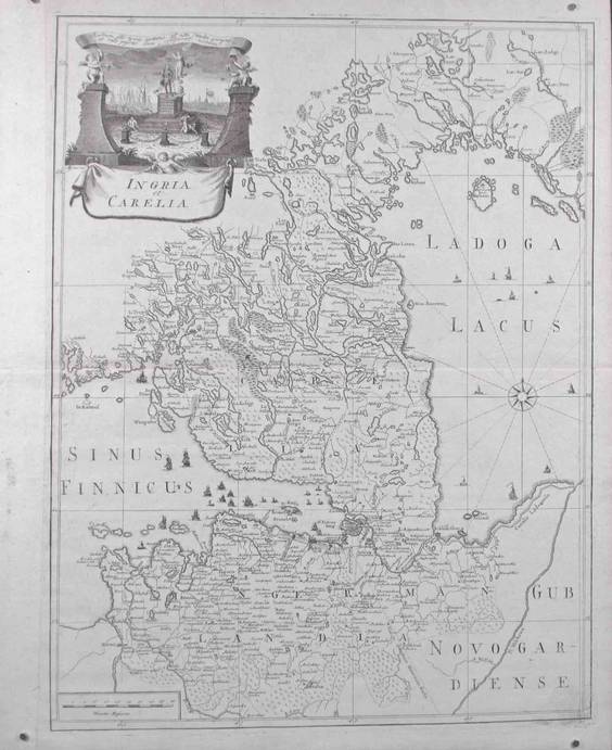
Ingria et Carelia
c. 1743 - Ingria und Carelia - B/W copper plate engraving - 60x46 cm - left margin contemporarily added to fit into the Atlas Russicus. Text in Latin
One of a set of maps of the surroundings of new St. Petersburg/Lago Ladoga. This series appeared without any date and there are no traces of publication in documents of the Akademiya Nauk (Bagrow II, p 184). They were probably published by the end of 1743. It should be noted that the aforementioned series of maps were all repeated in a new edition by Seutter in Wien (Bagrow).
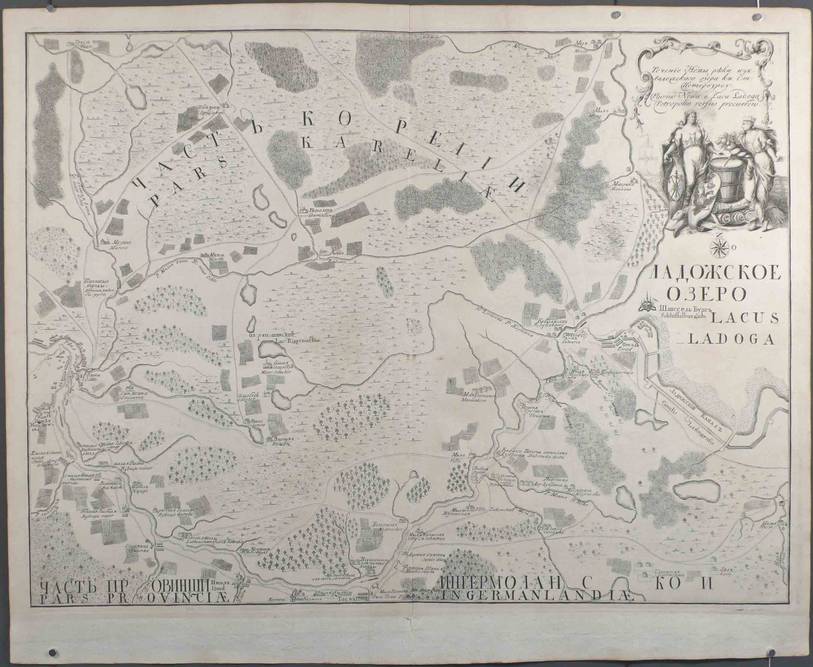
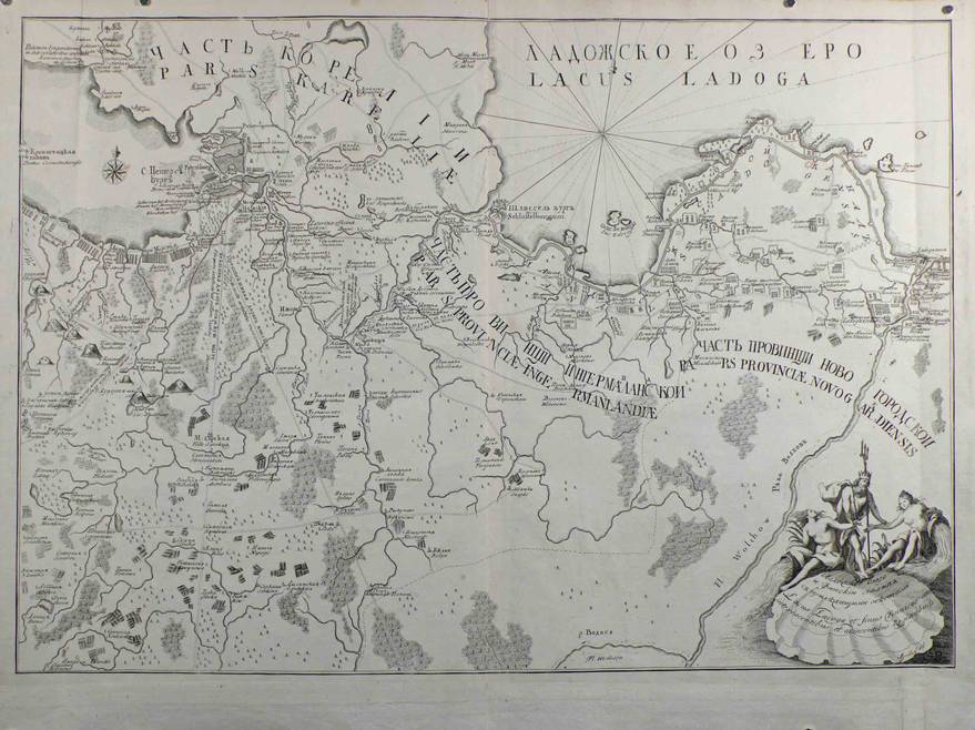
Lacus Ladoga
c. 1743 - B/W copper plate engraving - 48x67 cm - lower margin added contemporarily to fit into the Atlas Russicus. This map shows the Lacus Ladoga and the Sinus Finicus. Text in Russian and Latin.
One of a set of maps of the surroundings of new St. Petersburg/Lago Ladoga. This series appeared without any date and there are no traces of publication in documents of the Akademiya Nauk (Bagrow II, p 184). They were probably published by the end of 1743. It should be noted that the aforementioned series of maps were all repeated in a new edition by Seutter in Wien (Bagrow).
Fluvius Newa
c. 1743 - B/W copper plate engraving - 46,5x61,5 cm - lower margin added contemporarily to fit into the Atlas Russicus. This map shows the course of the Neva River. Text in Russian and Latin.
One of a set of maps of the surroundings of new St. Petersburg/Lago Ladoga. This series appeared without any date and there are no traces of publication in documents of the Akademiya Nauk (Bagrow II, p 184). They were probably published by the end of 1743. It should be noted that the aforementioned series of maps were all repeated in a new edition by Seutter in Wien (Bagrow).