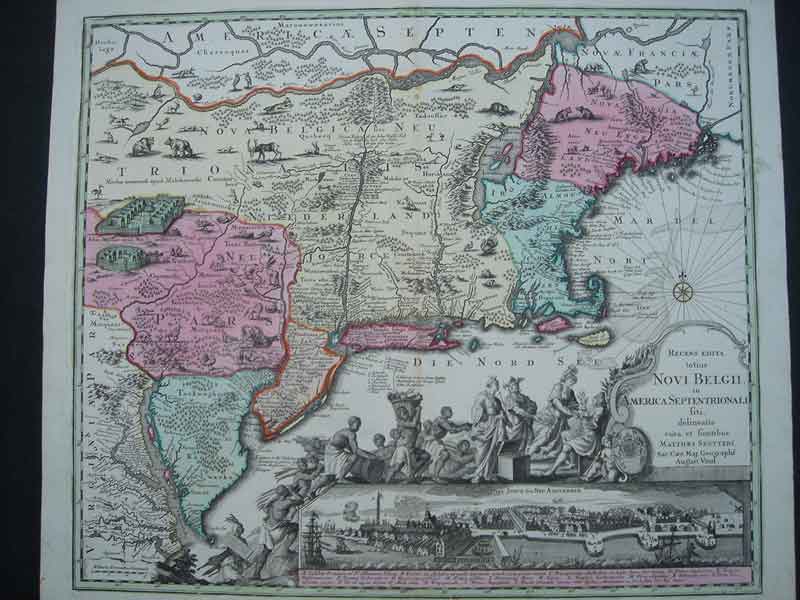
Recens Edita Novi Belgii... (New York)
ca. 1730. Second state (Tooley 291).
Full contemporary colour. Inset view of New York. Large cartouche in B/W as issued.
Excellent print.
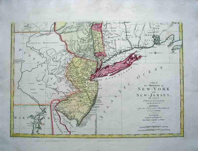
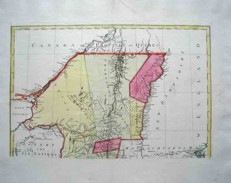
Province of New York and New Jersey
1777 Augsburg
One big map in two sheets
Original colour
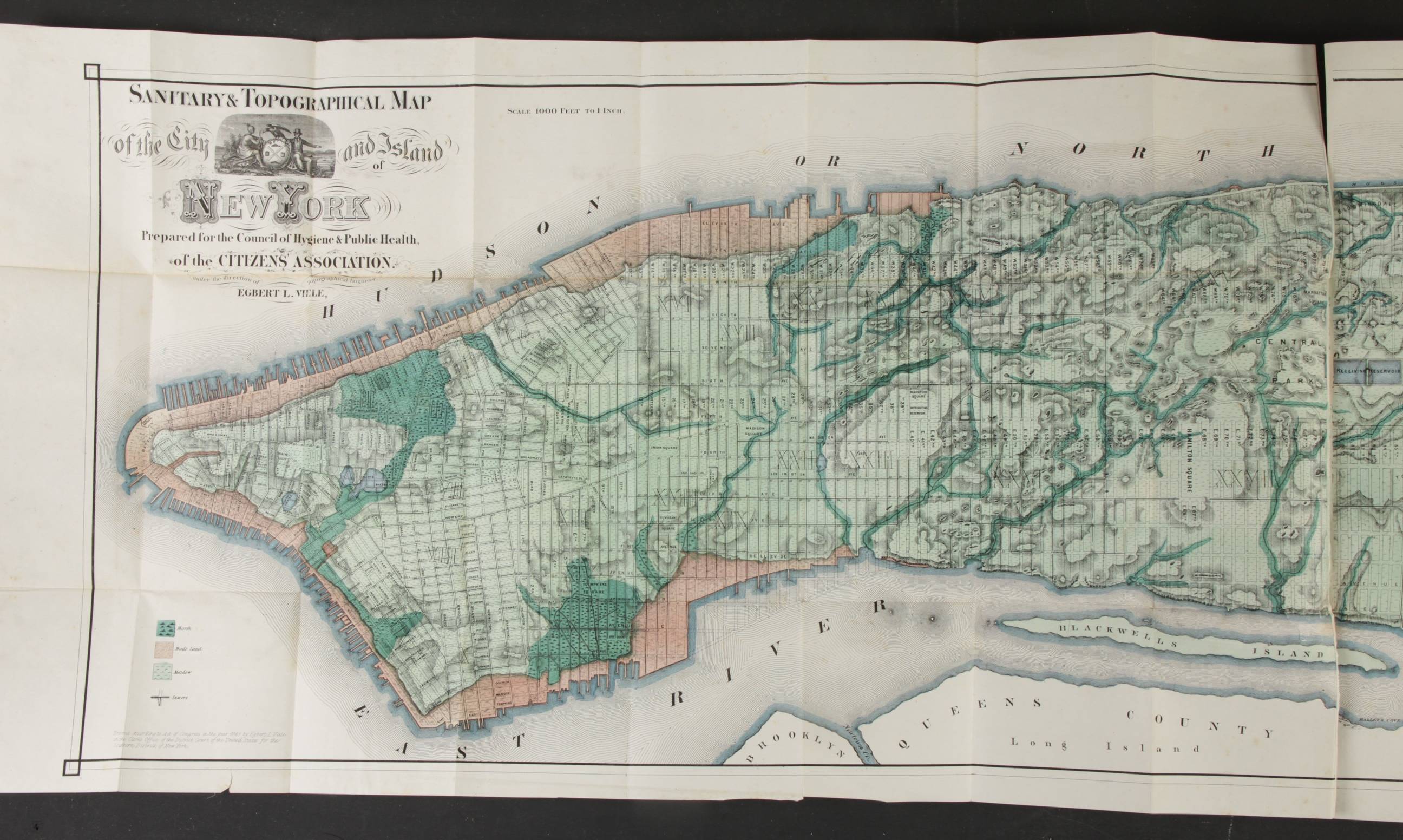
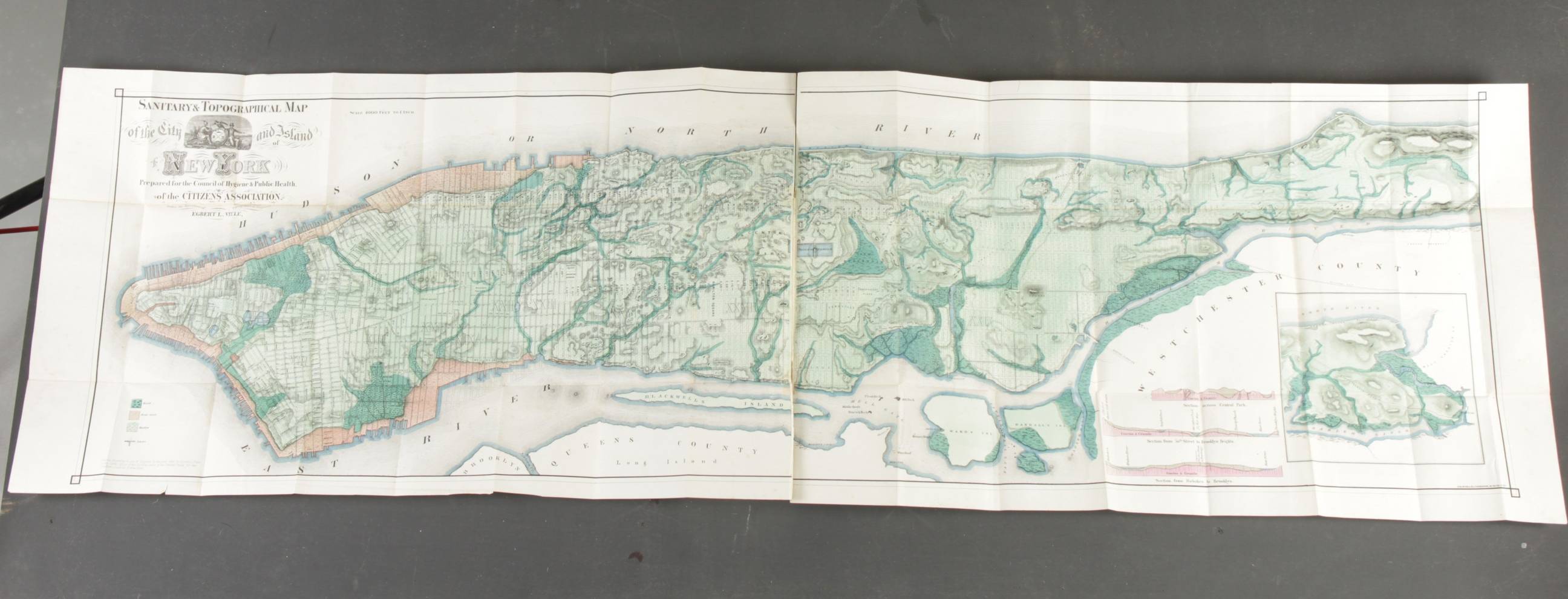
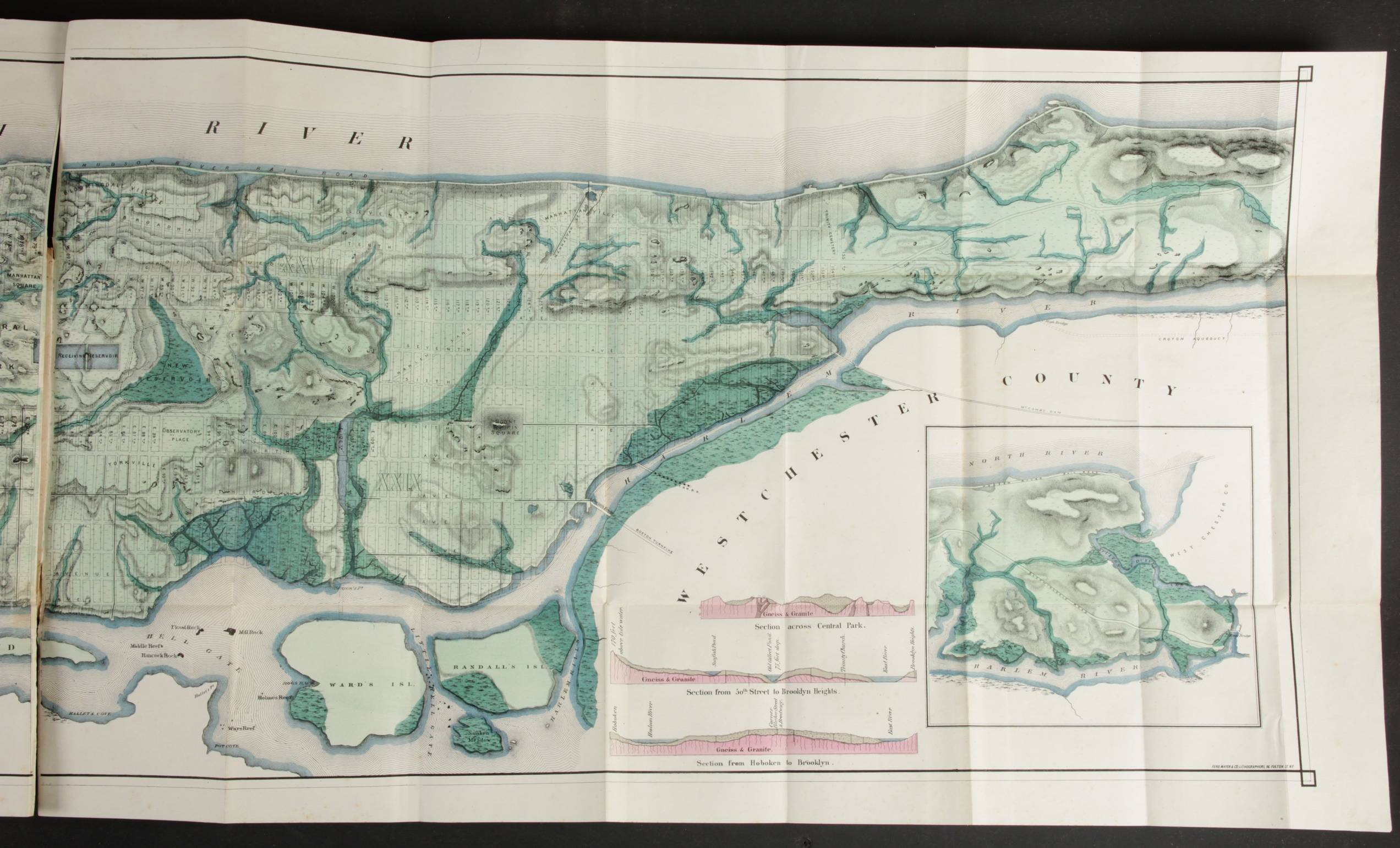
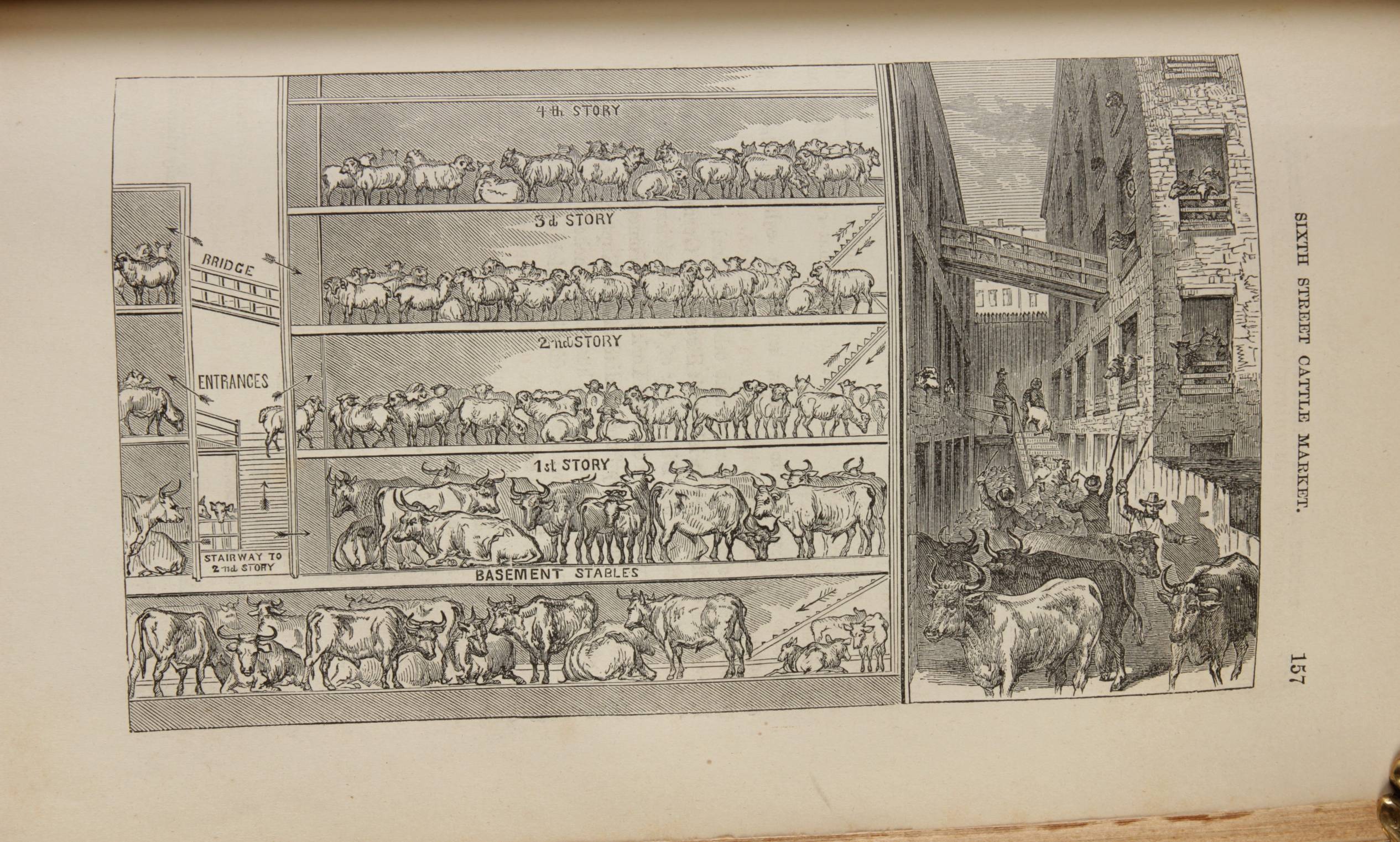
Report of the Council of Hygiene
Sanitary conditions of New-York
New York, Appleton and Co. 1866
In octavo, contemporary quarter black Morocco
Title in gilt on the spine
2 free blank end leaves; 18 pages;
FIRST PART: Title leaf ; Large folding map of New York
pp 21-36: Introduction
pp 37-144: Report ..on the sanitary condition of the city,
including 5 illustrations
SECOND PART:
pp 1-350: Reports of the sanitary inspectors,
including one folding map and 46 illustrations
pp 351-360: Index
Condition: excellent
This is the second edition (first 1865) of a path breaking public health study by 29 teams in the 29 districts that constituted XIX century New York. It documents the direct ...