 Jefferys Th.


 Jefferys Th.
The West-Indian atlas
London, Sayer & Bennet 1775
Sabin 35970;
Grand folio (56x42 cm).
Modern half Morocco
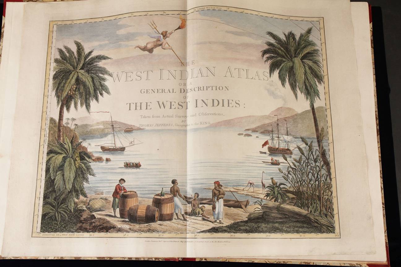
Engraved title page
2 nn lvs; 27 pp;
39 charts, 36 of them double page all in later colour.
The maps measure c 50x63 cm each.
Rare first edition of this detailed, maritime atlas of the Caribbean.
Thomas Jefferys was an outstanding cartographer and publisher...the finest maps of the time of North America and the West Indies For that reason his North American Pilot; West India Atlas and American Atlas went through many re-issues by Sayer and Bennet and Laurie and Whittle. Ours, the very first edition of the West Indian (maritime) Atlas, is rare.
The nucleus of this maritime atlas is the chart of the Caribbean, the size of a wall (circa 340x210 cm), drawn on 16 mapsheets. These charts are separate in the atlas but can be put together and showing all Capes; Rocks, Shoals and Soundings...published with all the expedition that a Work of this kind will permit Besides a maritime atlas the West India atlas it is also pilot ...showing both the geographic and hydrograpic parts
The composition of the atlas is highly functional and quite unusual. After the magnificent double page frontispiece and two title pages there are 28 pages of text detailing in broad terms the geography, population, products, religions etc of the coasts of the Gulf of Mexico and the Caribbean between Key West in Florida till the Gulf of Maracaibo.
Thereafter opens the map section of the atlas. That section opens with 6 double page maps of the route between Europe and the Caribbean: the English channel; the Atlantic Ocean; the Canary Islands; the Azores; the Cape Verde islands and finally Bermuda. Then follows an index chart of the West Indies, showing how the next 16 maps should be put together to form a huge wall map of the Gulf of Mexico and the Caribbean. Next come the 16 maps, 8 of them detailing the coast of Mexico and Central America. The atlas closes with another 16 charts of the mayor islands showing both coast, harbours and shoals but also detailing the islands inland including Cuba, Jamaica and Curacao